Utility Potholing and Locating in Texarkana, Texas
Vacuum and hand potholing and electronic locating for Texarkana sites, giving verified depth, size and material of buried lines before design or excavation.
Texarkana was a major railroad center by 1948, the junction of four railroad systems with eight outlets. Cities that grow around rail grow with a lot of buried history: old water mains, abandoned gas lines, cable duct that served long-gone businesses and drawings that stop being accurate a few years after they are filed. A plan sheet shows where somebody thought a pipe was. Potholing shows where it actually is.
Utility potholing is the careful excavation of a small hole to expose a buried line, so that its depth, size, material and exact position can be measured before a machine digs near it. Locating is the first step, using utility owners' marks and electronic tracing to find lines from the surface. Together they give a designer, a contractor or a property owner true information about the ground, and they are the cheapest protection against a strike.
We coordinate potholing and locating for utility and concrete work, and for other contractors who want the data before they commit to a route. The sections below explain the methods, what the results are good for and where the work matters most in this market.
Locate, then look
The sequence begins with a one-call locate request, which brings utility owners out to mark their lines. Marks are a good start, but they are approximate: a paint mark on pavement does not tell depth, and owners mark only what they own. We add electronic tracing for lines that are not marked, such as private service lines, old abandoned mains and non-metallic pipe that needs a tracer wire.
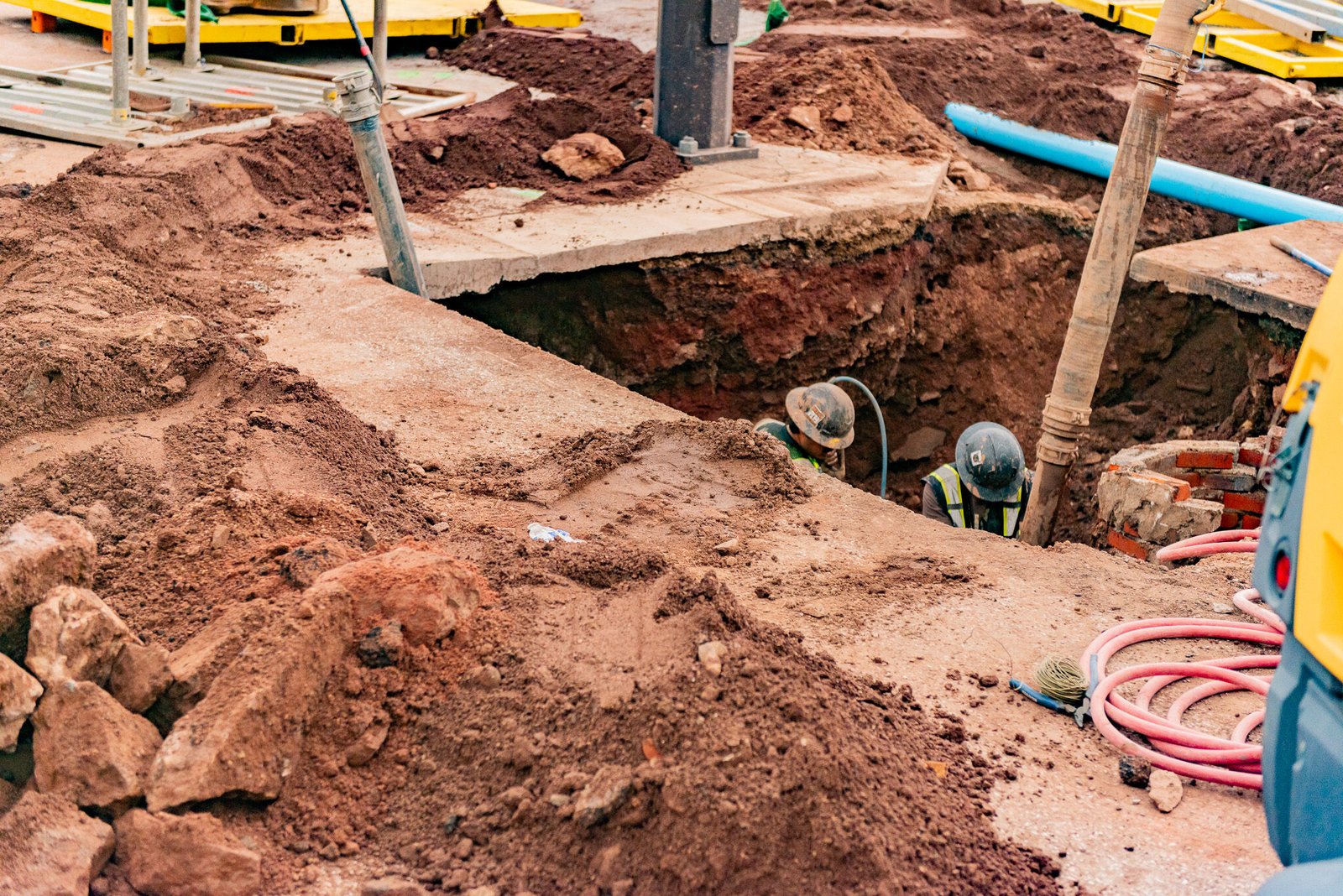
Then we dig. Vacuum excavation uses a high-pressure air or water jet and a vacuum hose to clear soil from around the line without touching it, and it is the standard for dense areas. Hand digging serves for shallow crossings and in places a truck cannot reach. In either case, we measure and record depth, size, material and direction.
Old ground and surprise lines
Red River Army Depot began as the Texarkana Ordnance Depot, with planning in 1939 and over 22,000 construction workers arriving to start building in 1941. A campus that grew that quickly, and keeps taking on new work, has layers of utilities that were installed, expanded, abandoned and sometimes forgotten. The same logic holds for any industrial site with a long history, including the former ammunition plant land at TexAmericas Center.
We treat unmapped lines as the normal condition, not the exception. A hole at each crossing is cheaper than a line strike, and the cost is small compared with redesign after a surprise. Where records and field data conflict, we trust the field and tell the engineer.
What you receive after potholing
Each pothole produces a record: a number or tag, a station and offset or survey coordinates, the depth to top of pipe, pipe size and material, the direction of the line and a photo with a scale. We backfill the hole in lifts and restore the surface to match. Marked holes can be surveyed to give the designer an accurate profile.
For a design team, the output goes into a utility conflict table. Where two lines cross at a depth that matters, the engineer redesigns before construction. For a contractor, the same data is a go-ahead or a stop sign: if the sewer sits 18 inches higher than drawn, the new storm line cannot go where it was planned.
Downtown renewal and tight corridors
The City of Texarkana, Texas downtown revitalization strategy builds on existing assets including the Arts and Historic District, the Farmers' Market and the Perot Theatre, with an arts-focused pedestrian promenade and a $100,000 National Endowment for the Arts Our Town grant. Streetscape work in an older downtown is some of the most conflict-filled construction there is: narrow rights of way, shallow utilities, historic structures and businesses that must stay open.
Potholing for that kind of project in central Texarkana has to move fast and leave little trace. We schedule work in short windows, cover holes with steel plates when needed and keep sidewalks open. Access for deliveries and customers is part of the plan.
Rules for digging near lines
Texas law requires notice to the one-call system before excavation, and utilities have a set time to respond. Facility owners may also have their own clearance rules about how close mechanical equipment can come to a pipeline or a cable, and some require a representative on site. Gas and high-voltage electric get the strictest treatment.
Work in public streets in Texarkana needs a right-of-way permit from the city. The City Inspections office handles building permits, and street work is coordinated with the city's engineering staff. We handle the paperwork and keep marks, tickets and records on site for inspection.
Pricing a set of holes
The main drivers are hole count, depth, the surface being cut, traffic control and restoration. Open ground with soft soil goes quickly. A hole through thick concrete or an asphalt street with a lane closure costs several times as much. Hard clay at depth slows vacuum work, and a water-filled hole is slower still.
A fair way to budget is to count every place where a new line crosses an old one, add the connection points and tie-ins, and then add a modest margin for the crossings nobody has found yet. The money spent on a hole is almost always smaller than the cost of one repair.
Where potholing pays off
It comes first on nearly every buried scope: utility relocation and site utilities.
It matters just as much before new water mains and the concrete work that follows. A footing that hits a live service line is a bad day, and potholing is cheaper than a repair.
Developers, municipalities and commercial developers use the same information during due diligence. Knowing what lies under a site, before buying it or designing for it, changes both price and layout. We also use it near the rail corridors, where company rules about digging near tracks add another layer.
Find the lines before you dig
Tell us the route and the crossing points. We will mark, expose and survey the lines, and send you a table of depths and materials your engineer can use.
Common Questions
What is the difference between locating and potholing?
Locating finds a line from the surface using marks or electronic tracing. Potholing exposes the line, so it can be seen and measured. Locating gives an approximate position, while potholing gives a verified one. Many jobs need both.
How much does a pothole cost?
Prices vary with depth, ground, surface restoration and the number of holes. Pavement cuts and traffic control cost more than open ground. Per hole costs fall when many holes are done in a single visit. We quote a per-hole rate with a minimum mobilization.
Can potholing damage a line?
Vacuum excavation is gentle on pipes and cables, and hand digging is gentler still. The risk is mostly in breaking through a hard coating or a loose joint. We use soft tools near the line and follow the utility's clearance rules.
Do I need potholing if I already have a survey?
A survey records visible features and marked locations. It does not show depth unless the line was exposed. Where a design depends on a crossing, a pothole is the only reliable way to know.
How do you find non-metallic pipe?
Plastic pipe has no signal unless it was installed with tracer wire. We use ground-penetrating radar in some cases, probe by hand and rely on records and potholes. For new work we always install tracer wire so the next crew can find it.